Hiking in Cebu: the best trails for every level
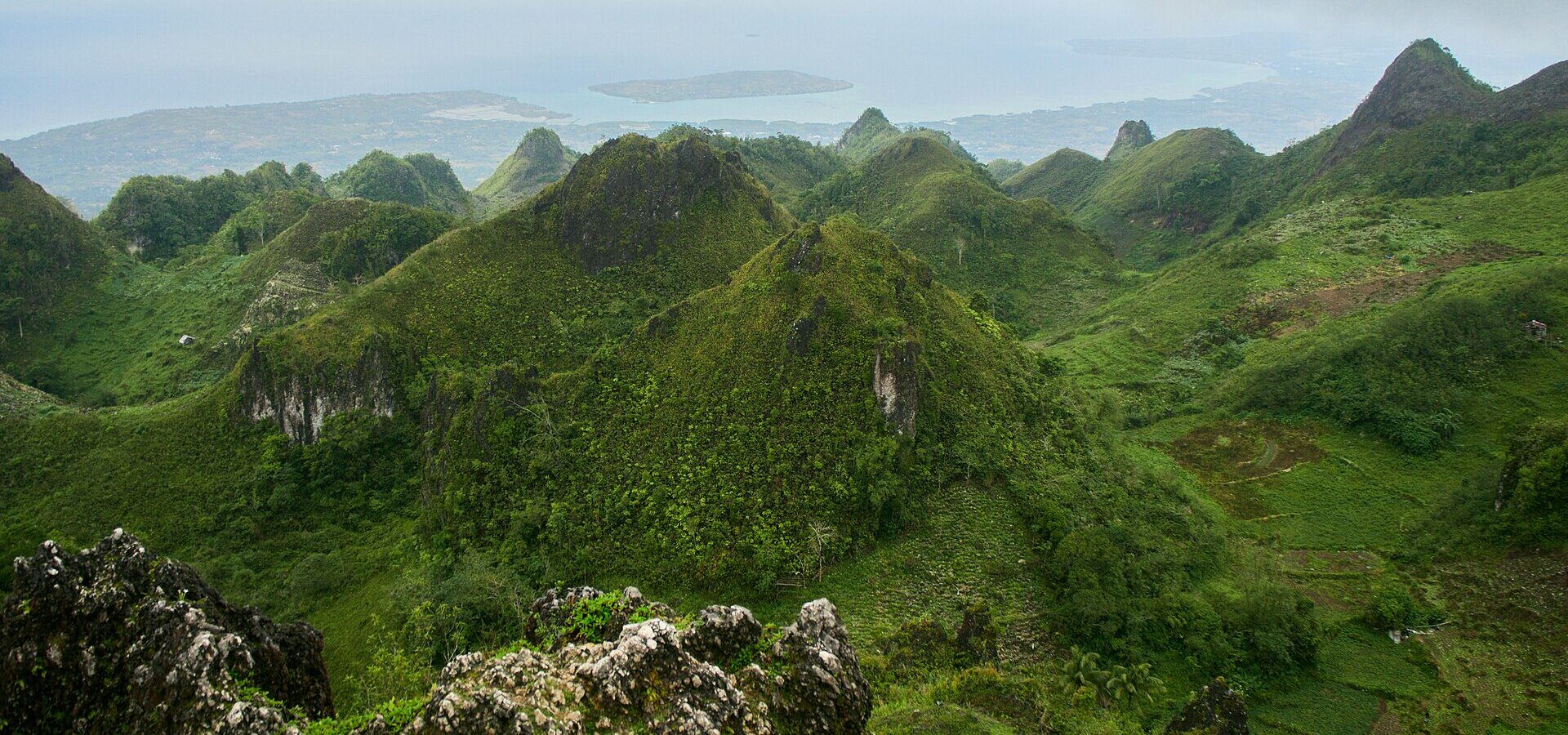
Cebu is famous for beaches, but the island has a long mountain spine down its middle. That means sunrise peaks, grassy ridges, jagged limestone and cool highland air, often only a few hours from the city. Some hikes take 20 minutes, others a full day.
Trail conditions, fees and rules change, and some mountains sit inside protected areas. Use this guide to choose, then check locally before you go.
Easy hikes (good for beginners)
- Osmeña Peak, Dalaguete: often called the highest point on Cebu, at roughly 1,000 metres, but the walk from the jump-off in Mantalongon is short, usually 20-30 minutes. Famous for sunrise over jagged hills. There is a small entrance fee.
- Casino Peak, Lugsangan, Dalaguete: a very short climb, around 10-15 minutes, to a rocky ridge with views of pointed green hills. Lovely at sunset and easy to combine with Osmeña Peak.
- Mt. Naupa, City of Naga: about 584 metres high, with an easier rolling route from Barangay Lanas and a steeper one from Barangay Cogon. Popular with beginners and for night hikes, about an hour from the city.
- Mt. Manunggal, Balamban: the short route from the Balamban side is an easy walk to the 1957 Magsaysay memorial and a grassy campsite. A great first overnight camp.
Moderate hikes
- Kandungaw Peak, Maloray, Dalaguete: about 30 minutes up concrete steps and a rocky trail to several viewpoints with sheer drops and views of the south coast. There is a small entrance fee. The cliff edges are dangerous: stay well back.
- Sirao Peak and the Busay hills, Cebu City: trails through farms, streams and small falls above the city, usually a few hours. Read our Busay guide for the area.
- Mt. Babag, Cebu City: the ridge behind the city is popular with local hikers and trail runners. The paths can be steep, dusty or muddy, and the night views of the city are beautiful.
Harder, full-day hikes
- Mt. Lanaya, Alegria: about 720 metres high, but you start near sea level, so it is a real climb, roughly 3-4 hours up. The reward is grassy slopes and wide views of the Tañon Strait and Negros. Register at the barangay and go with a local guide.
- Mt. Manunggal from Tabunan: the classic long route from the uplands of Cebu City takes most of a day through farms, forest and rocky ridges. Hire a guide.
- Osmeña Peak to Kawasan Falls: a popular trek from the Mantalongon highlands down to the coast at Badian, usually about 3-5 hours, ending with a swim at the falls. It is hot and steep in parts, so go with a local guide.
Guides, registration and fees
- Most trails have a registration point at the jump-off or the barangay hall. Sign in, pay the small fees and tell them your plans.
- For short, busy trails like Osmeña Peak, a guide is usually optional. For long or quiet routes, hire a local guide. You support the community and you will not get lost.
- Fees are usually small, often under ₱100 per person, but guide rates and camping fees vary. Bring cash in small bills.
- Many jump-offs are reached by habal-habal (motorbike taxi). Agree on the price first and ask for a helmet.
- Parts of central Cebu are inside the Central Cebu Protected Landscape. Stay on the trails and follow local rules.
Heat, rain and the best season
The dry season, from about December to May, is the best time to hike. March to May can be very hot, so start before sunrise and be off exposed ridges by late morning. From June to November, rain makes trails slippery, rivers can rise fast and fog hides the views. Do not hike during a storm warning. Read the best time to visit Cebu and our typhoon season tips.
- Carry at least 1.5-2 litres of water per person for a half-day hike, more when it is hot.
- Wear a hat, sunscreen and light, long sleeves on open ridges.
- Know the signs of heat exhaustion: dizziness, headache, nausea. Stop, rest in the shade and drink.
- Mountain tops can be cold and windy at dawn. Bring a light jacket for sunrise hikes.
- Mobile signal can be weak. Download an offline map and tell someone your plan.
Leave No Trace
Cebu's mountains are farms, water sources and homes. Please keep them beautiful.
- Carry out all your rubbish, including wrappers, cigarette ends and bottles.
- Stay on the trail and do not walk through crops or vegetable gardens.
- Do not pick flowers, cut trees or write on rocks.
- Use toilets where they exist. Keep away from springs and streams if there are none.
- Make fires only where allowed, keep them small and put them out completely.
- Keep noise down at campsites and greet the people you meet. Our Cebuano phrases will help.
- Read more in responsible travel in Cebu.
What to bring
- Shoes with good grip, ideally trail shoes or hiking sandals.
- Water, snacks and some electrolyte drinks.
- Headlamp for sunrise hikes, with spare batteries.
- Rain jacket or poncho and a dry bag for your phone.
- Small first-aid kit, cash in small bills and a power bank.
- For the full list, see our Cebu packing list.
Want to see the views without the effort? Many peaks are perfect at sunrise or sunset, and our sunrise and sunset spots list includes easy ones. For more ideas, see day trips from Cebu City and our Cebu waterfalls guide.
Photo: "Pico Osmeña - Osmena1857" by lumoplank, via Wikimedia Commons, released into the public domain (CC0).
